South Drogheda Environs
| Amendment No.: | Proposed South Drogheda Amendment No. 1 |
| Submission/ NOM/ (FTF) NOM Numbers |
MH-C5-816 The Office of the Planning Regulator |
| Chapter/Section |
Land Use Zoning Map |
| Proposed Material Amendment | |
|
Amend STH DRO OBJ 1 in Section 4.0 Town Development Policies and Objectives as follows; To prepare, as a priority, a Joint Vision and Urban Area Plan for Drogheda in partnership with Louth County Council within the lifetime of this Plan in accordance with the requirements of Regional Policy Objective 4.11 of the RSES for the Eastern and Midland Region and the recommendations set out in the Report of the Drogheda Boundary Review Committee published in February 2017. |
|
| Amendment No.: | Proposed South Drogheda Amendment No. 2 |
| Submission/ NOM/ (FTF) NOM Numbers |
MH-C5-624 |
| Chapter/Section |
Land Use Zoning Map |
| Proposed Material Amendment | |
|
Include the following new objective in Section 4.0 Town Development Policies and Objectives as follows; STH DRO OBJ XX: To support the preparation of a Local Transport Plan for Drogheda, in conjunction with Louth County Council and in consultation with the National Transport Authority and other relevant stakeholders. |
|
| Amendment No.: | Proposed South Drogheda Amendment No. 3 |
| Submission/ NOM/ (FTF) NOM Numbers |
MH-C5-557 |
| Chapter/Section |
Land Use Zoning Map |
| Proposed Material Amendment | |
|
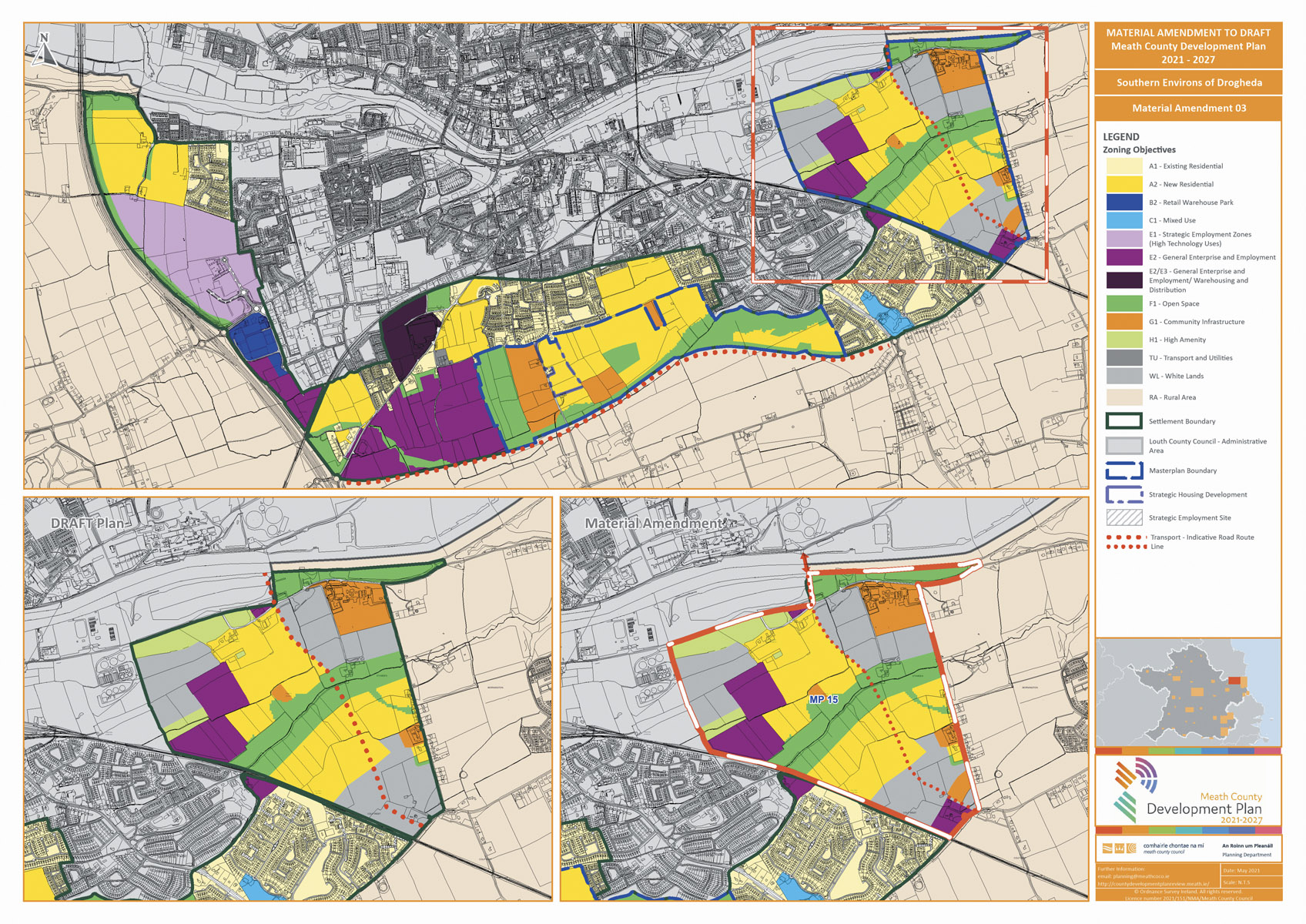
Add Masterplan boundary around these lands as per the existing Drogheda Land Use Zoning Map 2013-2019.
Proposed amendment - Masterplan boundary shown |
|
| Amendment No.: | Proposed South Drogheda Amendment No. 4 |
| Submission/ NOM/ (FTF) NOM Numbers |
MH-C5-557 |
| Chapter/Section |
Land Use Zoning Map |
| Proposed Material Amendment | |
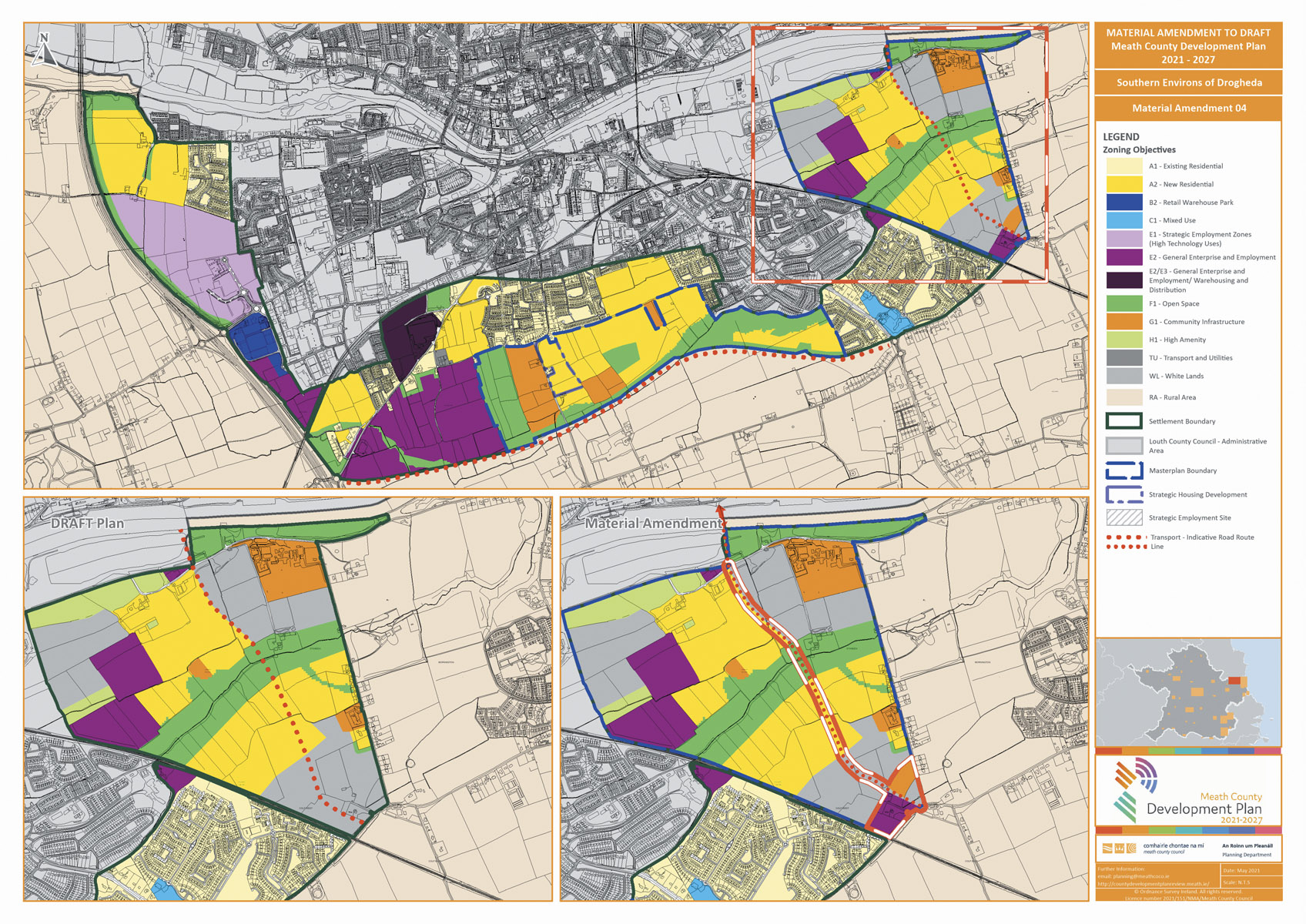
Proposed Land Use Zoning Amendment from WL to G1 and E2 and realignment of the indicative road |
|
| Amendment No.: | Proposed South Drogheda Amendment No. 5 |
| Submission/ NOM/ (FTF) NOM Numbers |
MH-C5-381 Brady Hughes on behalf of the Farrellys |
| Chapter/Section |
Land Use Zoning Map |
| Proposed Material Amendment | |
|
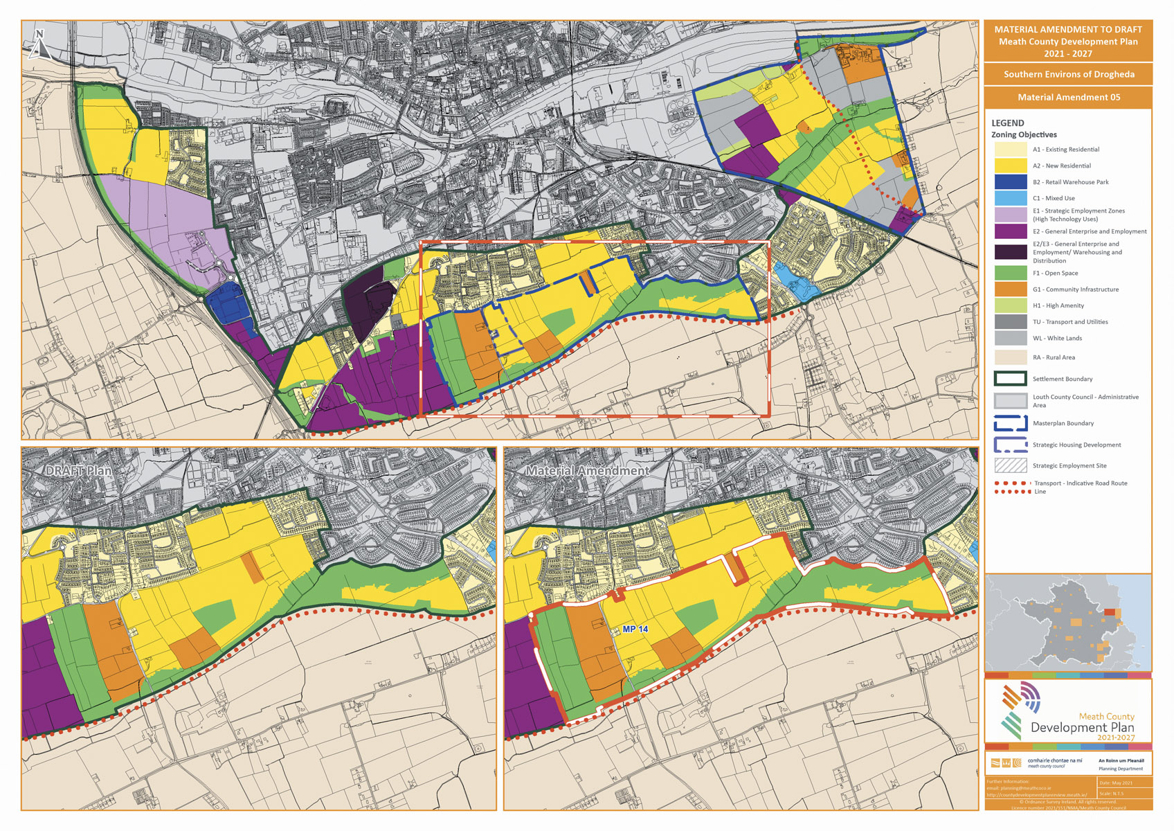
Masterplan boundary and label to be inserted on the Land Use Zoning Map
Amended map showing the Masterplan boundary |
|
| Amendment No.: | Proposed South Drogheda Amendment No. 6 |
| Submission/ NOM/ (FTF) NOM Numbers |
MH-C5-736 Fergus O’Dowd TD |
| Chapter/Section |
Land Use Zoning Map |
| Proposed Material Amendment | |
|
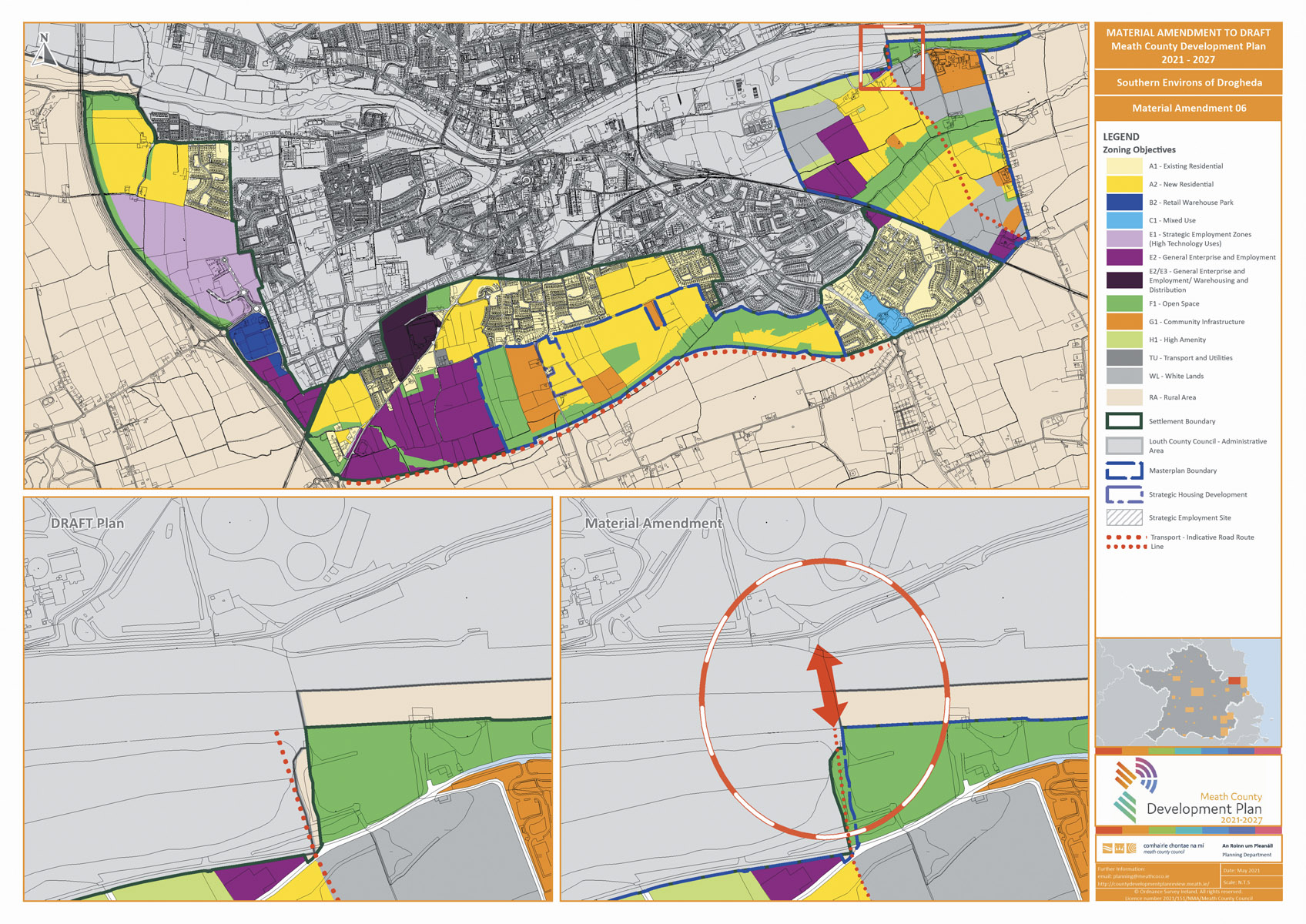
Reinstate the Indicative location for a new road bridge over the River Boyne to connect the Dublin Road traffic South of Colpe Cross to the North of Drogheda. This location will be assessed in greater detail as part of the preparation of a Transport Study and Joint Urban Area Plan for Drogheda in conjunction with Louth County Council.
Arrow indicates the location potential bridge crossing |
|
|
SEA Consultant Comments Development of any resulting projects shall be subject to requirement for screening for requirement for EIA and AA. Where not required development proposals shall include Ecological Impact Assessment and Cultural Heritage Impact Assessment, as appropriate. |
|